Cliffhanger Solutions

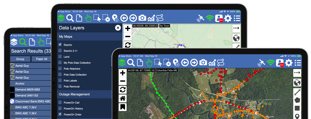
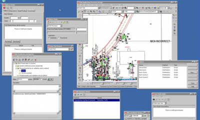
Our goal is to make Spatial data accessible, searchable and usable, which leads to better decision making opportunities. Our GIS platform is highly scalable, adaptable and available on desktop and mobile devices. Our focus is to make sense of valuable and available GIS data anywhere.

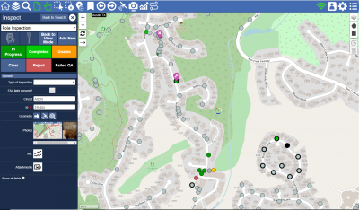
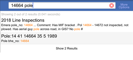
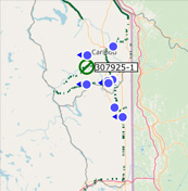
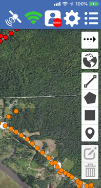
Additionally, our platform easily allows crews to capture data in the field. Vegetation Management, Pole Inspections, Safety Inspections, Walking Surveys and Damage Assessment are just a few use cases. Work assignments, data validation, audit trails and real-time dashboards are all integrated.

GIS projects often become frustrating because developers in the industry can not deliver according to expectations. We have frequently taken over such projects where others fall short. Simply put, we can deliver according to expectations with enterprise level GIS solutions.

USE CASES

Inspections

Pole, Valve, Substation, Distribution, Transmission Inspections and more.

Ease

Easily configurable inspection forms and the ability to assign inspections to crews while monitoring their progress and location in real time.

Vegetation Management

Survey, adjust and assign to trimming crews with ease. Monitor progress in real time.
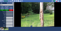
Assign Line Sections with Ease

Full audit trail provides the data a utility requires to prove compliance. Crew performance is taken in to account when assigning work, ensure the most efficient way to get the job done and outages minimized!

Safety Violation Inspections

Capture the findings, add pictures, create reports and monitor audit trails.

Full Audit Trail & Reporting

Add pictures of your inspection and create automated reports.

Damage Assessment

Quickly report damage to the office and dispatch restoration crews.

Full Audit Trail & Reporting

Add pictures of the damage and use a form to indicate required equipment with either free text, or from pull downs, including compatible units. Back office gets the data in real time for efficient crew assignments.

Surveys

Walking survey, driving surveys made easy using device integration and optimized routing.

Ease

Automate survey processes by highlighting assets when getting closer, automated routing options, capturing data automatically and integrate with measuring equipment. All while the back office is updated automatically and in real time.

Outage Management

Outages, outages calls and crew locations in real-time.

Powerful plug-in for Google Maps

Combine GIS data with weather data, crew locations, outages and affected customers to optimize restoration assigments.

Cyber Security

Track Login Attempts, Firewall Intrusions, Physical Access, Server Access.

Identify threats and raise alerts in case of detected intrusions.

Preventive Maintenance

Track maintenance, improve up time and limit liability.

Full Audit Trail & Reporting

Add pictures of actions taken, add documents to support it and automatically add to the audit trail. Prove that what needed to be done was performed on time and correctly.

Location Tracking

Need to know where your crew is?

Ease

Know where your crew is in relation to outages.

Products You Will Love

Atlas

The most popular solution for any field process that includes a location.

All the functionality you need

to perform Inspections, Survey’s, Assessments, Maintenance and more. From view only to work assignments and real time progress dashboards.

Cloud maps for Smallworld

Want to display your Smallworld data on top of Google, Bing, Open Street Maps or others? Just a simple plugin adds that to your object control.

All the functionality you need

Do you want to see your Smallworld data on top of Google or other map services, inside Smallworld GIS?

Look no further! Choose from a variety of street, satellite and topo maps.

Just load a Smallworld module or plugin and you will be up and running instantly.

Insight for Smallworld

Need to have a better insight into your GE Smallworld usage?

All the functionality you need

Easily install into existing applications and let it run for days, weeks, or months. All within an intuitive and interactive dashboard. Shows UVA, memory, method and other usage and anomalies.

Search for Smallworld

Add Google Search like capabilities to Smallworld.

All the functionality you need

Dozens of Gazetteer or Browser widgets are no longer required. Supports ranking as well! Replace search windows like these:

with one single search bar.

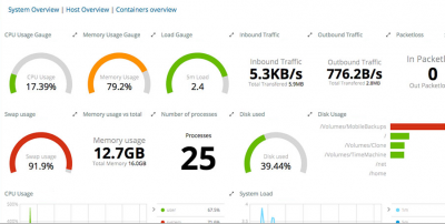
Features That Matter

Turn your data into useful information

High Performance Search

The Atlas high performance search as you type search engine supports a “Google Style” search out of the box, no configuration needed or indices to setup. Search all your connected datasets in real time. Auto suggestion and context highlighting for fast results.

Beautiful User Interface

With years of GIS experience, we know what it takes to deliver an intuitive and rich user experience in the midst of a complex landscape. Let our experience, and our app, make geo spatial data easier to use.

  • Rich Dynamic Search Features

  • GE SmallWorld Integration

  • Advanced Machine Learning

  • Real Time Data Analytics

  • Damage Assessment

We Can Help!

Geospatial Services

Cliffhanger Solutions offers consulting services ranging from 24×7 GIS support, to enabling real-time access to your enterprise data using proprietary GIS software. Most of our team members are GIS veterans with well over 20 years experience each that have been keeping up to date with the latest GIS technologies.

Who we are – at the core:

We want to focus on the best possible way to search, access and use your data. This implies that our services are meant to not only keep your existing systems up and running, but also that our customers expect us to be pro-active to suggest and provide solutions to improve usability, accuracy, up-time and performance.

We believe that:

  • Our customers are our partners
  • Data should be available from anywhere, on any device, even for your clients!
  • Services and solutions don’t have to cost a fortune.
  • Pro active is better than reactive.
  • We can be serious without wearing a tie.

Services We Offer

GeoSpatial Consulting 100%
GIS Maintenance & Support 100%
Machine Learning 100%
GeoData Analysis 100%
SmallWorld Integration 100%
ESRI Integration 100%

For more information or a demo please fill out the form below or call :

[contact-form-7 id="311" title="Contact form 1"]