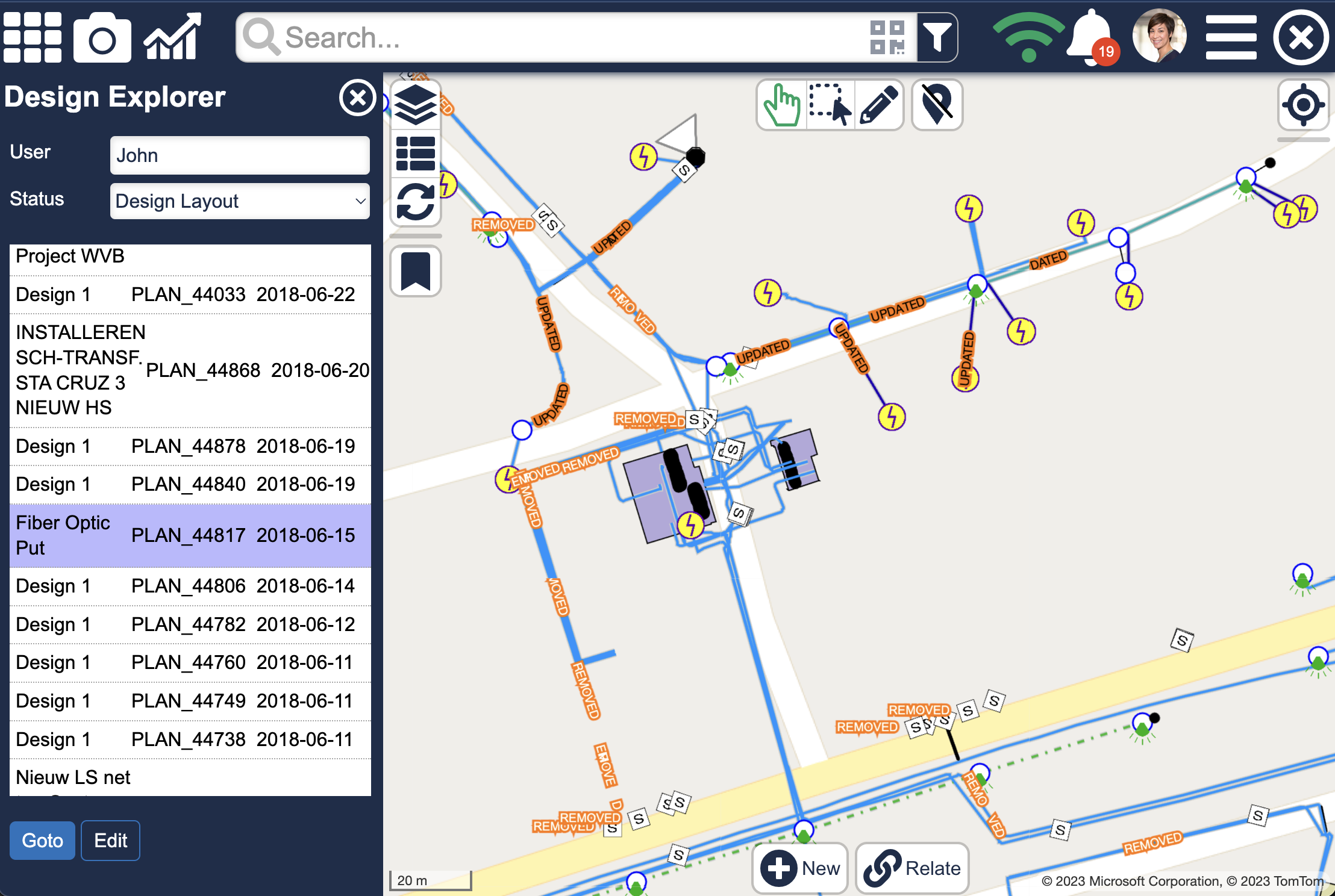
We are pleased to announce that a new feature in Atlas now allows you to explore different versions of your data. This is very helpful when work orders or designs are utilized. It enables you to consider your planned job as an integral part of your current network. In addition, you will be able modify or add new data, augment with redlining, or if you are using Atlas in the field, capture photos.
Administrators may even view every design at once or switch between them instantly. Users are able to manage their progress and performance via analytics dashboards.
If necessary, this functionality can also be used offline and is accessible on both desktop and mobile devices (iOS and Android).
In order to provide a two-way data flow and adhere to back office business requirements, Atlas Designs may be linked with already-existing GIS systems like ESRI or Smallworld Design Manager. Additionally, you have the choice to make brand-new designs (referred to as “ad-hoc”) while you are out in the field.
Some key points:
- Instantly switch between design and master view
- Make design changes, add redlining and photos
- Works both online and offline
- No limit to the number of designs (thousands are supported)
- No ‘extract areas’, works on whole service territory
- Design view options:
– master only, no design (=current view)
– design only, no master
– master faded + design
– design (=future view) - Integrates with workflow
- Supports Smallworld Version management
- Integrates seamlessly with Smallworld Design Manager covering electric, telecom and water networks
- No translation: no ETL or FME required
- Design status and progress dashboards
- GridOS compliant
- Works on phones, tablets
More screenshots of this functionality can be found here.

